NOTE: While it's possible to add properties/ownership data manually through the Ownership tool, it is more efficient to add the data through the Map Object tool. More information on that can be found here.
Property
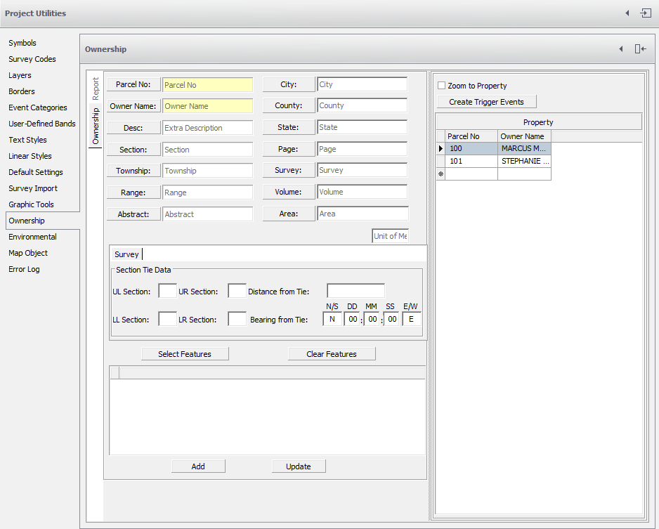
Adding Properties
Aside from specifying the necessary information for each property, two field values are required to make the necessary link to an entity in the drawing:
- Parcel Number
- Owner Name
NOTE: an entity must be selected by clicking the Select Feature button and selecting the polyline in AutoCAD. When all the appropriate fields are populated, click the Save button to add the property.
- Multiple lines of text may be selected, Esc the command to return to the New Property dialog.
- When selecting features make sure to select only one entry and one exit for each property section. A new property is needed every time the alignment leaves or enters a property line.