NOTE: The Scan tab will scan the entire model space portion of the drawing and write this data to the Skyline database. If errors are found in the file while writing the point data, the location and type of error will be written to the Error Log Table. For more information on the Error Log Table, please review the Error Log article.
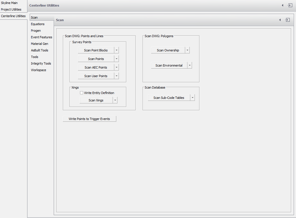
Scan
.
| Scan Point Blocks |
Scans for a variety of standard common point blocks used in the CAD industry, and calculates the station and offset of the point relative to the current Centerline. Gathers the X and Y values, the description and elevation, and writes out all information to the Project database. |
| Scan Points | Scans all nodes on the drawing file. Calculates the station and offset of the point relative to the current Centerline. Uses the layer name as the description and writes the X and Y values to the Skyline database. (Does NOT gather the point no. or elevation). |
| Scan AEC Points | Only applies when using Land Development in AutoCAD. Gathers the data from the custom objects created with Land; also scans the entire model space portion of the drawing file and calculates the station and offset of the points relative to the current Centerline. |
| Scan User Points | Scans user defined points on the drawing file. Calculates the station and offset of the point relative to the current Centerline. Uses the layer name as the description and writes the X and Y values to the Skyline database. (Does NOT gather the point no. or elevation). |
| Scan Crossings (Xings) | Scans the entire model space portion of the drawing file and calculates the station of all polyline or line entities crossing the current Centerline. Uses the Layer table to determine the description and write out all information to the Skyline database. |
| Scan Property | Scans the entire model space portion of the drawing file and calculates the station of all polyline or line entities of the properties crossing the current Centerline. It uses the Property table to determine the description and write out all information to the Skyline database. |
| Scan Sub-Code Tables |
Does not scan the drawing file. but instead scans the sub-code tables which were created and populated through the Survey Import found in Project Utilities. No changes will be made to the drawing file, but will calculate the station and offset of the points found in the sub-code table relative to the current Centerline. |
NOTES:
Xings
- The layers must be created and defined prior to scanning. To create layers review the Layers guide. Press the ‘. .’ button () to view the Layer Data dialog.
- The current version of the application will now scan crossings on a 3D polyline Alignment. Although theoretically there are no true crossings, the application will use the elevation along the Alignment with the x and y of the theoretical intersection.
Property
- Properties must be created and defined prior to scanning. To create Properties review the Properties guide. Press the ‘. .’ button () to view the Ownership Data dialog.
NOTE: The sub-codes table must be populated prior to scanning.
Edited by Noah Waters 11/8/22